

Reimagining urban rivers
Using breakthrough visual tools and environmental data to redesign the L.A. River—so that it meets the demands of a 21st-century climate and serves those who live on its banks.
USC Launched 2022
Share this page
Partners
We picked a section of the L.A. River with the highest flood vulnerability to design a new approach to integrated planning.
During the first phase of the project, we focused on an 11-mile stretch called Glendale Narrows—a dirt-bottomed part of the river prone to increased flood risk. That gave us the chance to test new data tools, run hands-on community workshops, and figure out better ways for engineers and residents to shape big projects together.
The new approach is pushing the redesign in exciting directions. This kind of planning could help other cities, too—building parks, events spaces, and roads that actually reflect what locals want and need.
Meet the project team

Carling Monder
Project Manager
Research team

Alex Robinson
Physical Modeling & Design
Associate Professor of Architecture & Spatial Sciences
Landscape Architecture + Urbanism program

Mitul Luhar
Hydraulics & Engineering
Henry Salvatori Early Career Chair
Associate Professor of Aerospace, Mechanical Engineering & Civil and Environmental Engineering
Andreas Kratky
AR Interface Design
Associate Professor of Cinematic Arts

Gale Lucas
Human-Computer Interaction
Research Associate Professor of Computer Science, Civil and Environmental Engineering, and Psychology

Josh West
Hydrology & Geomorphology
Professor of Earth Sciences and Environmental Studies

Patrick Lynett
Computational Modeling
Professor of Civil and Environmental Engineering


Partners

Deborah Weintraub
City of Los Angeles, Bureau of Engineering

Luz Rabelo
City of Los Angeles, Bureau of Engineering

Kayla Gailing
City of Los Angeles, Bureau of Engineering

Brian Baldauf
Mountains Recreation and Conservation Authority

Rebecca Correa
Mountains Recreation and Conservation Authority
Recent Updates
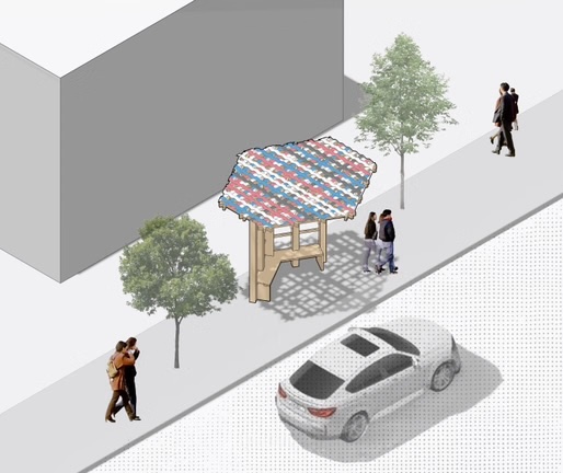
ShadeLA design contest winners envision a cooler Los Angeles (literally)

USC Architecture unveils jury and awards for ShadeLA and Shade Zones Competition
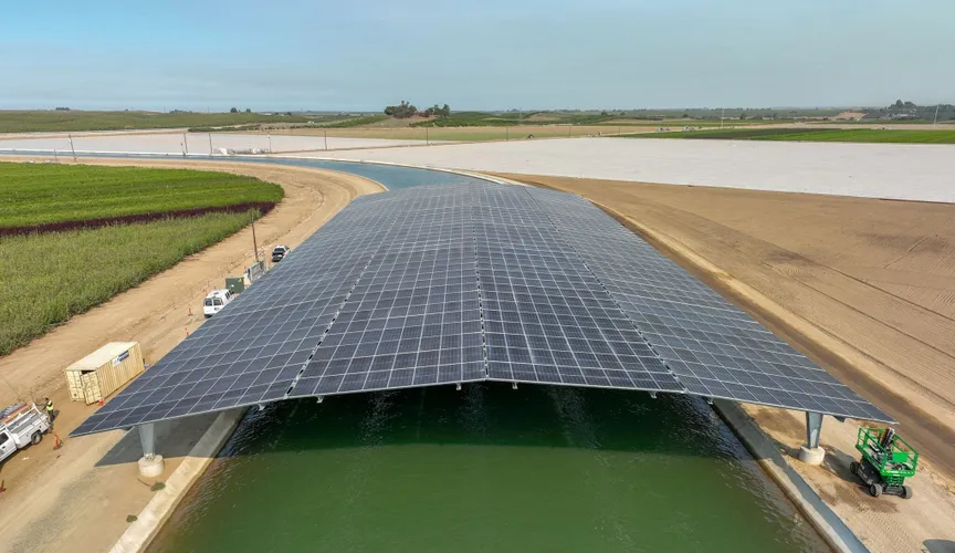
California’s first solar-covered canal comes online
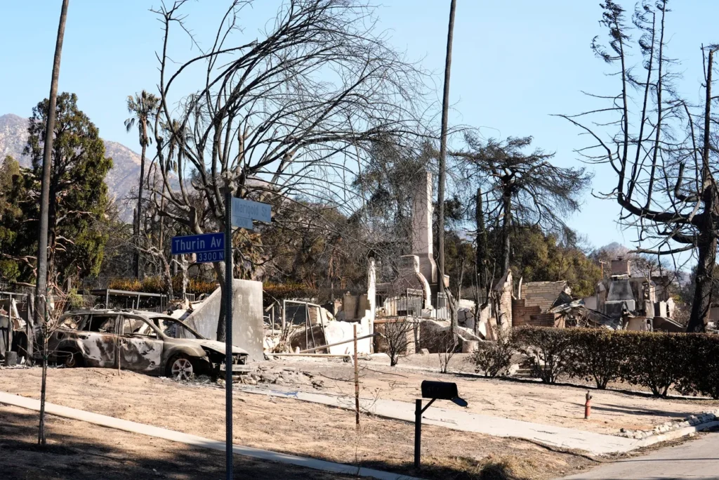
Homeowners trying to rebuild after Altadena’s Eaton Fire face concerns over lead levels in soil
Related Projects
IJLA Infrastructure Scorecard: Landscape View

- USC
Testing L.A.’s oceans and rivers after the 2025 wildfires
Measuring water quality post-wildfires to understand potential health and environmental risks.

- USC
Greening L.A.’s hottest streets
Bringing more trees, shade, and fresh air to L.A. by identifying where, what kind, and how many trees to plant for the biggest impact.